
DOMS is needed by the marine and satellite research communities to support a range of activities. Use cases include, but are not limited to (1) iterative calibration/validation of satellite retrieval algorithms, (2) decision support for designing and implementing field campaigns, (3) scientific investigations (e.g., developing blended satellite-in situ products, process studies), and (4) quality control of surface marine observations. For example, satellite cal/val requires a user to identify co-located satellite observations to observations of the same type from ships, buoys, or floats. For each in situ measurement, the user must determine whether or not a satellite observation can be matched to the in situ data with sufficiently small space and time tolerances. Traditionally, researchers match observations by downloading large volumes of satellite and in situ data to local computers and using independently developed one-off software. Frequent repetition of this process consumes substantial human and machine resources. The proposed service will provide a community accessible tool that dynamically provides data matchups and allows the scientist to only work with the subset of data where the matches exist.
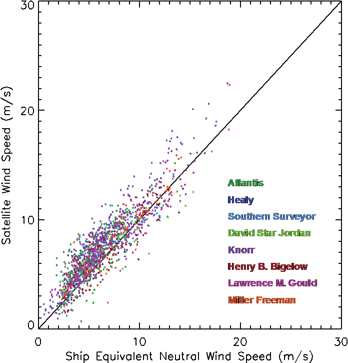
Example comparing collocated ship and satellite scatterometer wind speed data.
This analysis was done during a validation exercise for QuikScat.