Ongoing
 |
Scatterometry (1996 - Ongoing)Scatterometers are unique among satellite remote sensors in their ability to determine the wind direction over water. Scatterometers can provide a wealth of wind velocity observations over the earth's bodies of water. These wind observations have a wide variety of applications including weather forecasting, marine safety, commercial fishing, El Nino prediction and monitoring, and long term climate studies. The exceptional accuracy of the recent NASA Scatterometer (NSCAT) is leading to development of new applications. At COAPS, we have found that examining animations of scatterometer winds can inspire new scatterometry applications. |
RVSMDC (1999 - Ongoing)The Research Vessel Surface Meteorology Data Center collects, quality-controls, archives, and distributes surface meteorological observations from research vessels operated by the United States and the international community. It is housed at COAPS. |
|
 |
FSU Fluxes (2005 - Ongoing)The goal of the FSU IN SITU FLUXES project is to provide and study better products for marine surface variability. In particular, we focus on the transfer (flux) of energy and momentum between the ocean and the atmosphere, as well as variables related to this problem (wind speed, wind vectors, sea surface temperature, air temperature, humidity, surface pressure, and wave characteristics). The FSU IN SITU FLUXES products are monthly averages, based solely on in situ observations (ships and buoys). The FSU SATELLITE FLUXES largely rely on satellite observations. One key advantage of the satellite-based products is finer resolution in space and time. A key advantage of the in situ-based product is the potential for a much longer time series. Additionally, the MDC continues to produce operational monthly gridded pseudostress fields for the tropical Pacific and tropical Indian Oceans (known as the FSU winds). |
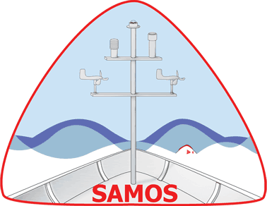 |
SAMOS (2005 - Ongoing)The Shipboard Automated Meteorological and Oceanographic System initiative provides routine access to accurate, high-quality marine meteorological and near-surface oceanographic observations from research vessels and select voluntary observing ships. It is housed at COAPS. |
 |
Rolling Deck to Repository (R2R) (2009 - Ongoing)With their global capability and diverse array of sensors, research vessels are essential mobile observing platforms for ocean science. Data collected on every expedition are of high value, given the high costs and increasingly limited resources for ocean exploration. The Rolling Deck to Repository (R2R) program aims to develop comprehensive fleet-wide management of underway data to ensure preservation of and access to our national oceanographic research data resources. R2R provides a gateway through which data are routinely cataloged and deposited in long-term archives, including the NOAA National Centers for Environmental Information (NCEI) (for data) and Chronopolis (for documents). Data are submitted to R2R by vessel operators rather than by individual science parties. |
 |
CDMS (2020 - Ongoing)The Cloud-based Data Match-Up Service (CDMS) is a collaborative effort between NASA Jet Propulsion Laboratory, COAPS, the National Center for Atmospheric Research, and Saildrone. CDMS is an extension of the Distributed Oceanographic Match-Up Service (DOMS) which was funded by the NASA AIST program. CDMS will provide a mechanism for users to input a series of geospatial references for satellite observations and receive the in situ or satellite observations that are matched to the primary satellite data within selectable temporal and spatial search domains. The software stack that enables CDMS match-up capability is available via the Apache Science Data Analytics Platform (SDAP), which is an Apache incubator project. Under the ACCESS program, the team plans to deliver a production-ready match-up capability that fully leverages cloud-native services. COAPS is providing SAMOS observations to CDMS as one of the in-situ data sources.
|
 |
MarineFlux (2021 - Ongoing)MarineFlux will establish a user-friendly web access point for the dissemination of turbulent air-sea fluxes and the essential ocean and climate variables (EOV/ECV) required to estimate the fluxes from surface in-situ platforms. The service will include fluxes derived from the International Comprehensive Ocean-Atmosphere Data Set (ICOADS), the Shipboard Automated Meteorological and Oceanographic Systems (SAMOS) initiative and select flux datasets from NOAA expeditionary cruises. Working with the international flux community we will ensure the service provides not only the observations, but the metadata required to support discovery, search, access, and application for a wide range of users. The service will provide both a web user interface, for human search and discovery, and restful web services to support machine-to-machine queries. |
Historical
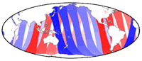
JMA (1970 - 2020)Some ENSO impact analyses, particularly those in COAPS, categorize application data as belonging to one of three phases of ENSO: El Niño (warm SST anomalies in the Pacific) El Viejo (cool SST anomalies), or neutral based on an index derived from observed SST anomalies. The particular index chosen is that from the Japan Meteorological Agency (JMA) because it selects well the known ENSO events. The index is a 5-month running mean of spatially averaged SST anomalies over the tropical Pacific: 4°S-4°N, 150°W-90°W. If index values are 0.5°C or greater for 6 consecutive months (including OND), the ENSO year of October through the following September is categorized as El Niño, El Viejo (index values equal or exceed -0.5°C), or neutral (all other values). A plot of these data show their relative values since 1970. |
|
TOGA-COARE (1992 - 1996)Observations of surface meteorological conditions during COARE are important and useful for defining the role of the ocean-atmosphere heat and momentum exchange in the warm pool region of the western tropical Pacific ocean. These types of observations are of relevance to various science investigations. For example, the winds are critical components for studies on ocean mixing, large-scale ocean circulation, waves, and air-sea fluxes. Similar levels of importance can be made for most of the other meteorological variables such as temperatures (both air and sea surface), humidity, barometric pressure, and perhaps other data such as precipitation or other auxiliary observations (cloud cover, recorded weather, etc.) if available. These data were observed/recorded from a number of instruments and platforms with varying degrees of accuracy and frequency during COARE. |
|
 |
GCOOS (2008 - 2016)The Southeast Archeological Center (SEAC) of the National Park Service (NPS) has partnered with the Center for Ocean-Atmospheric Prediction Studies (COAPS) at the Florida State University to conduct an assessment of the risks posed by ongoing climate change to cultural resources at national parks in the Southeast. Preliminary studies have identified modern, colonial, and pre-colonial atmospheric and oceanographic data that can be used to assess the risks to irreplaceable cultural resource sites within Canaveral National Seashore and Everglades National Park. At these sites, rising sea level combined with the exposure of the Florida Peninsula to hurricanes are the most prominent risks to cultural resources. |
 |
ASK Florida (2010 - 2013)MDC staff and students contributed to the NASA funded Advancing Student Knowledge Through Teacher Education (known as "ASK Florida") to increase middle school teachers' content knowledge in climate change science and their ability to identify and use scientific and teaching tools to incorporate climate education in the classroom. |
 |
NPS (2011 - 2013)The Southeast Archeological Center (SEAC) of the National Park Service (NPS) has partnered with the Center for Ocean-Atmospheric Prediction Studies (COAPS) at the Florida State University to conduct an assessment of the risks posed by ongoing climate change to cultural resources at national parks in the Southeast. Preliminary studies have identified modern, colonial, and pre-colonial atmospheric and oceanographic data that can be used to assess the risks to irreplaceable cultural resource sites within Canaveral National Seashore and Everglades National Park. At these sites, rising sea level combined with the exposure of the Florida Peninsula to hurricanes are the most prominent risks to cultural resources. |
Deep-C Consortium (2011 - 2015)The Deep-C Consortium is conducting a long-term, interdisciplinary study of deep sea to coast connectivity in the northeastern Gulf of Mexico. |
|
 |
ICOADS Value-Added Database (IVAD) (2011 - 2015)MDC personnel participated in the joint development of IVAD with NOAA's Earth Systems Research Laboratory (lead), NOAA National Centers for Environmental Information, and the National Center for Atmospheric Research. The IVAD project aimed to confront the complex obstacles associated with our current inability to trace value-added improvements back to individual ICOADS observations, specifically through (a) establishment of a database management system to support development of value-added records and facilitate user access, (b) implementation of supporting modifications to the International Maritime Meteorological Archive (IMMA) format, and (c) scientific demonstration of the impact of value-added records on air-sea flux estimates and common climate indicator series. |
 |
SCS-DAC (2014 - 2017)The Scientific Computing System Data Assembly Center (SCS-DAC) has been tasked with managing the flow of SCS data from the vessel to NCEI following each project (cruise). The data assembly center at FSU provides a single point of contact for vessel operators and technicians and act as a liaison with NCEI. The SCS-DAC will ensure the timeliness of data delivery from the end of project until the data has been published and is made available for public download. The SCS-DAC will also develop an automated assessment of each data package and assign each dataset a completeness rating, ensuring that the data is collected correctly from the various scientific instruments on board the NOAA fleet. An Issue Tracking System (ITS) will help land-based data quality analysts track and find solutions to problems regarding data collection and submission. |
 |
DOMS (2015 - 2018)The Distributed Oceanographic Match-up Service (DOMS) is a web-accessible service tool that reconciles satellite and in situ datasets in support of NASA’s Earth Science mission. The service provides a mechanism for users to input a series of geospatial references for satellite observations (e.g., footprint location, date, and time) and receive the in-situ observations that are “matched” to the satellite data within a selectable temporal and spatial domain. |